Services Cartography Gallery Software Contact →
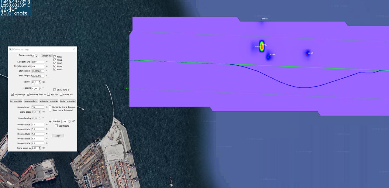
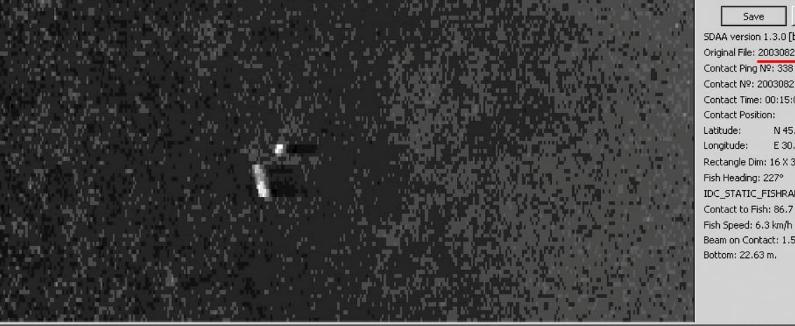
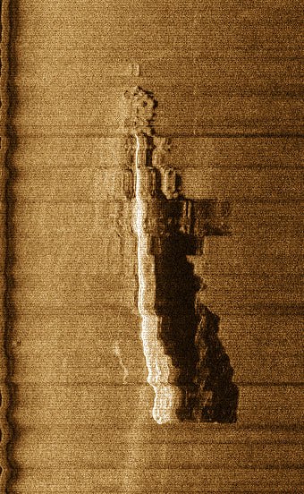
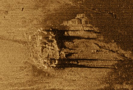
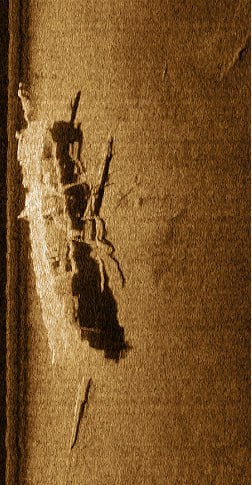
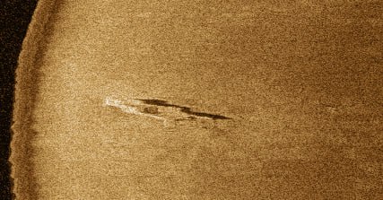
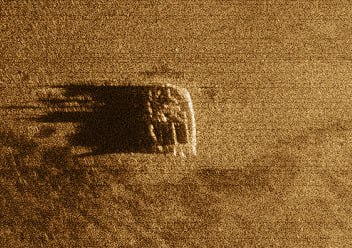
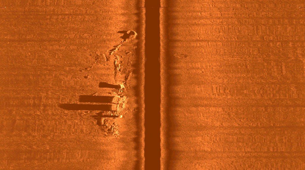
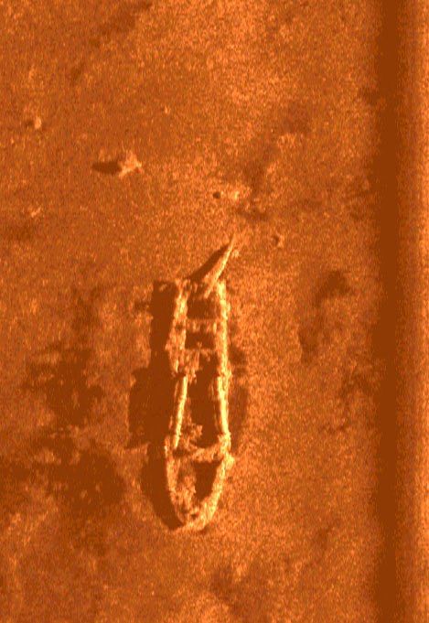
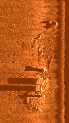
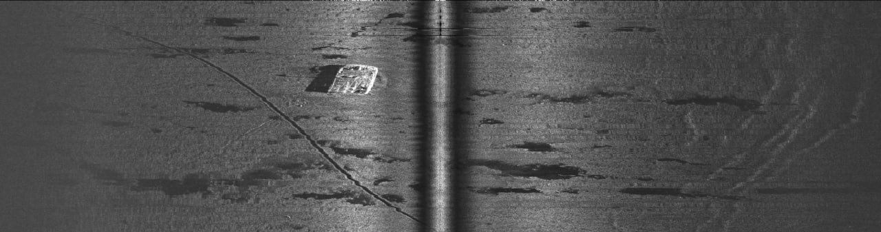
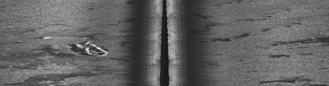
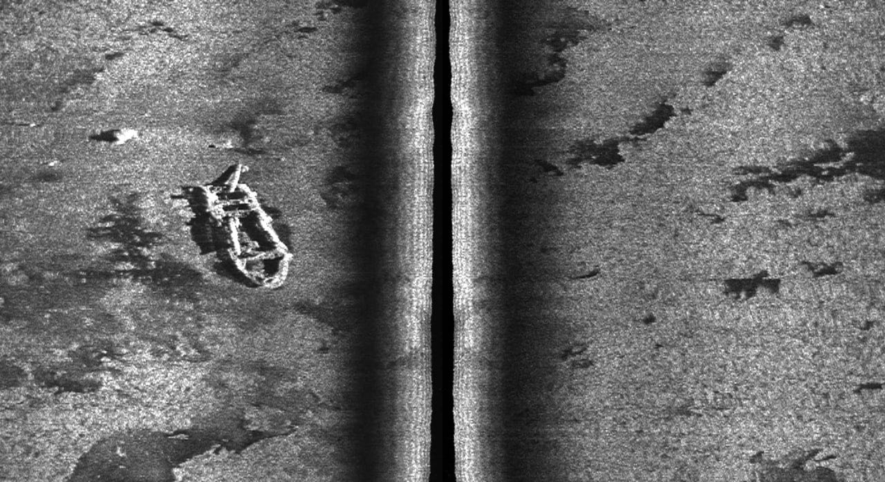
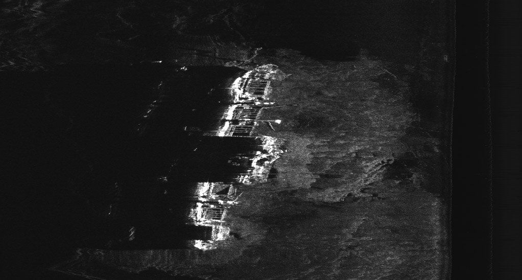
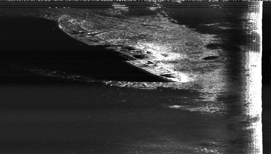
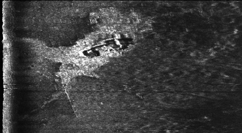
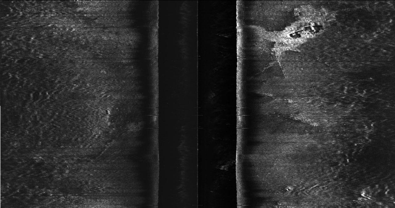
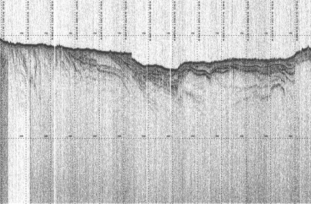
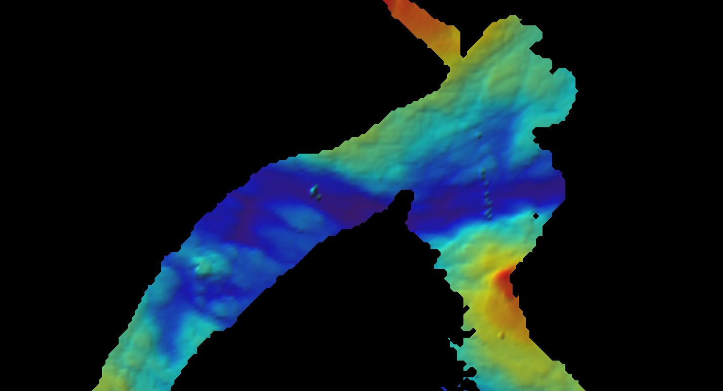
SSS · Live · 400 kHz
Sonarvia
// Sonar Engineering & Hydrographic Survey
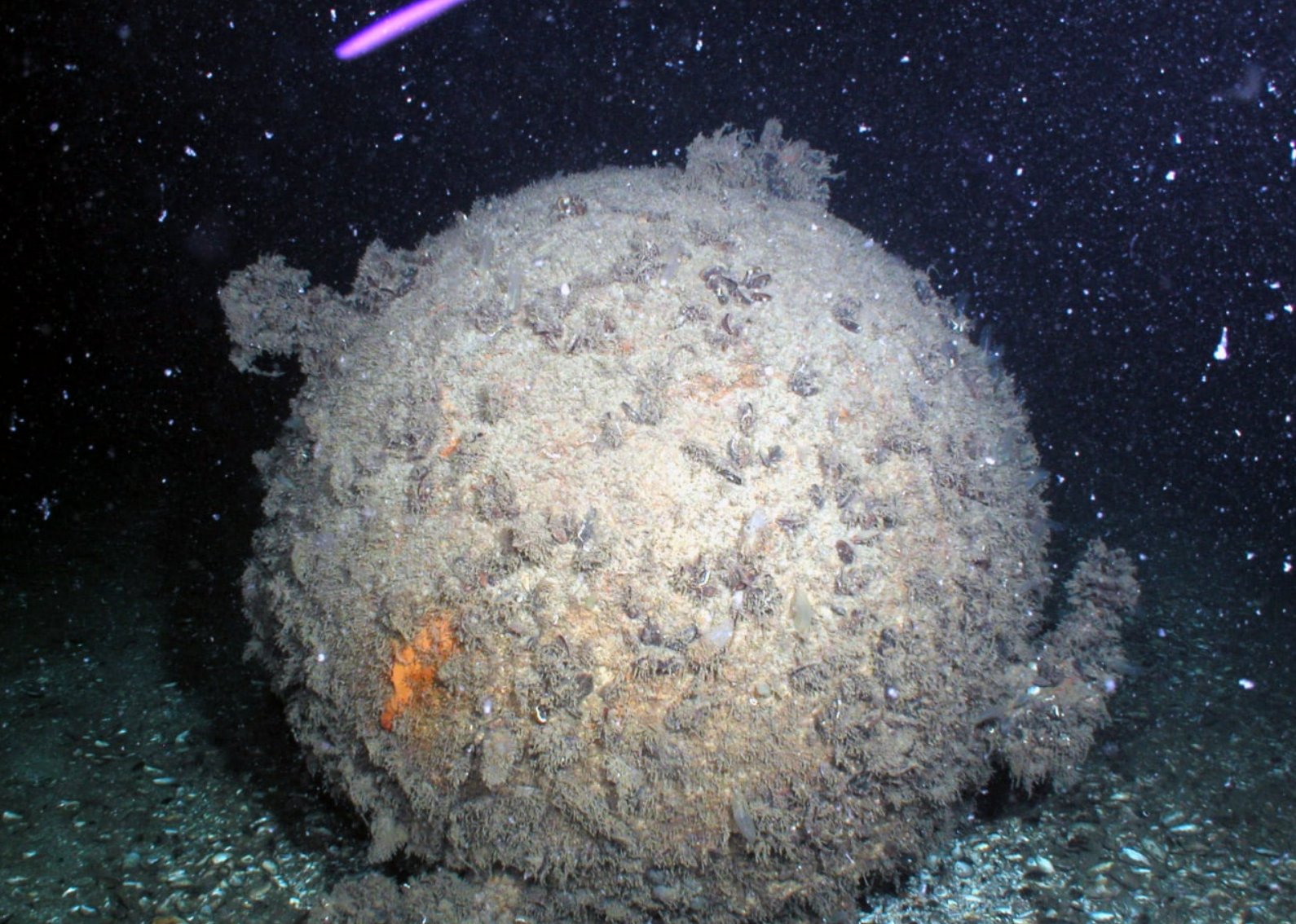
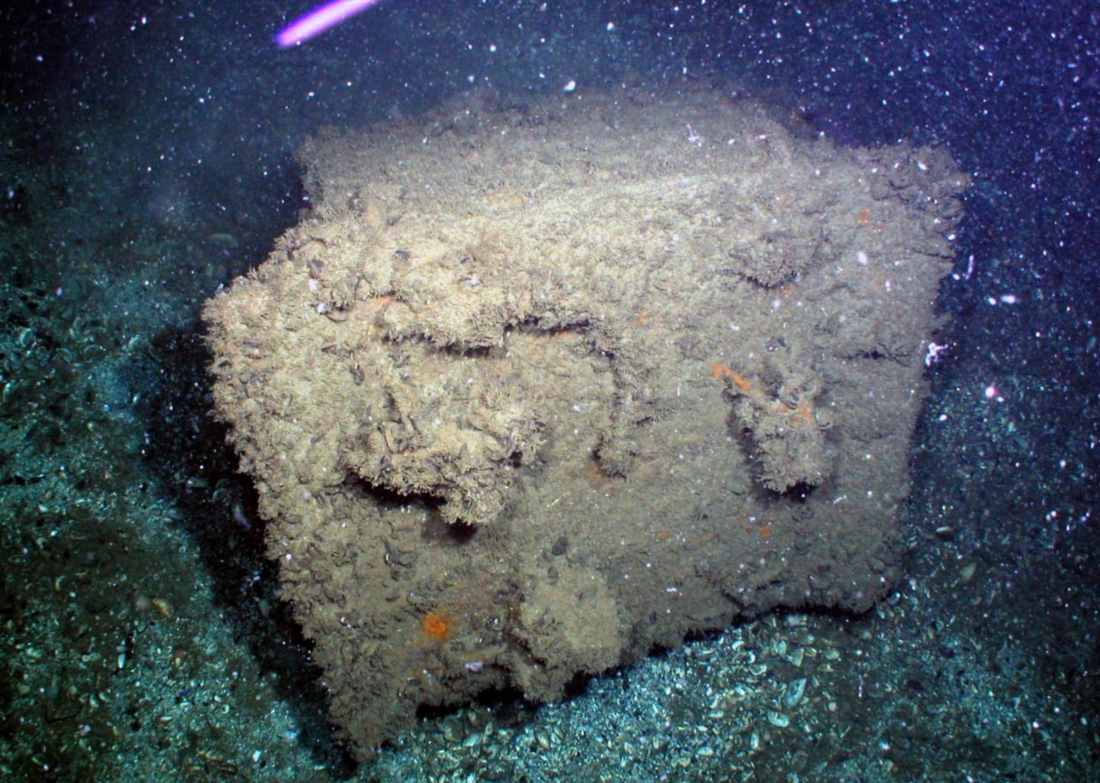
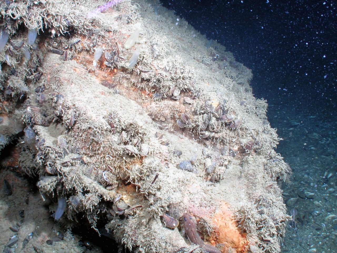
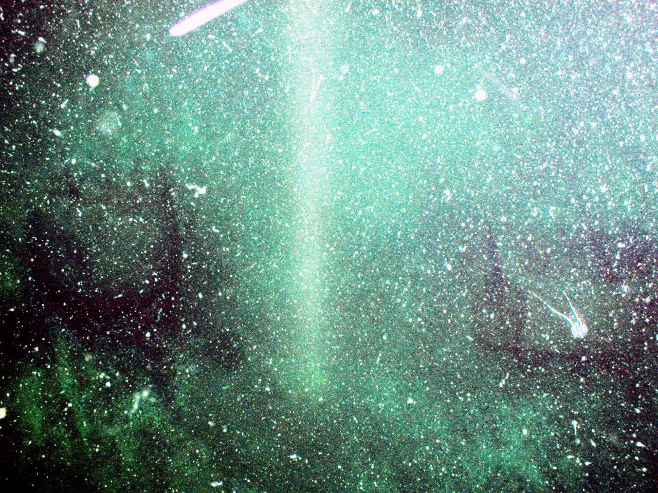
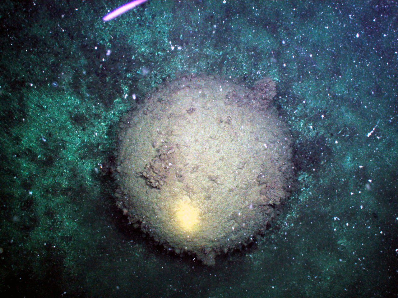
We Map
What Lies
Beneath.

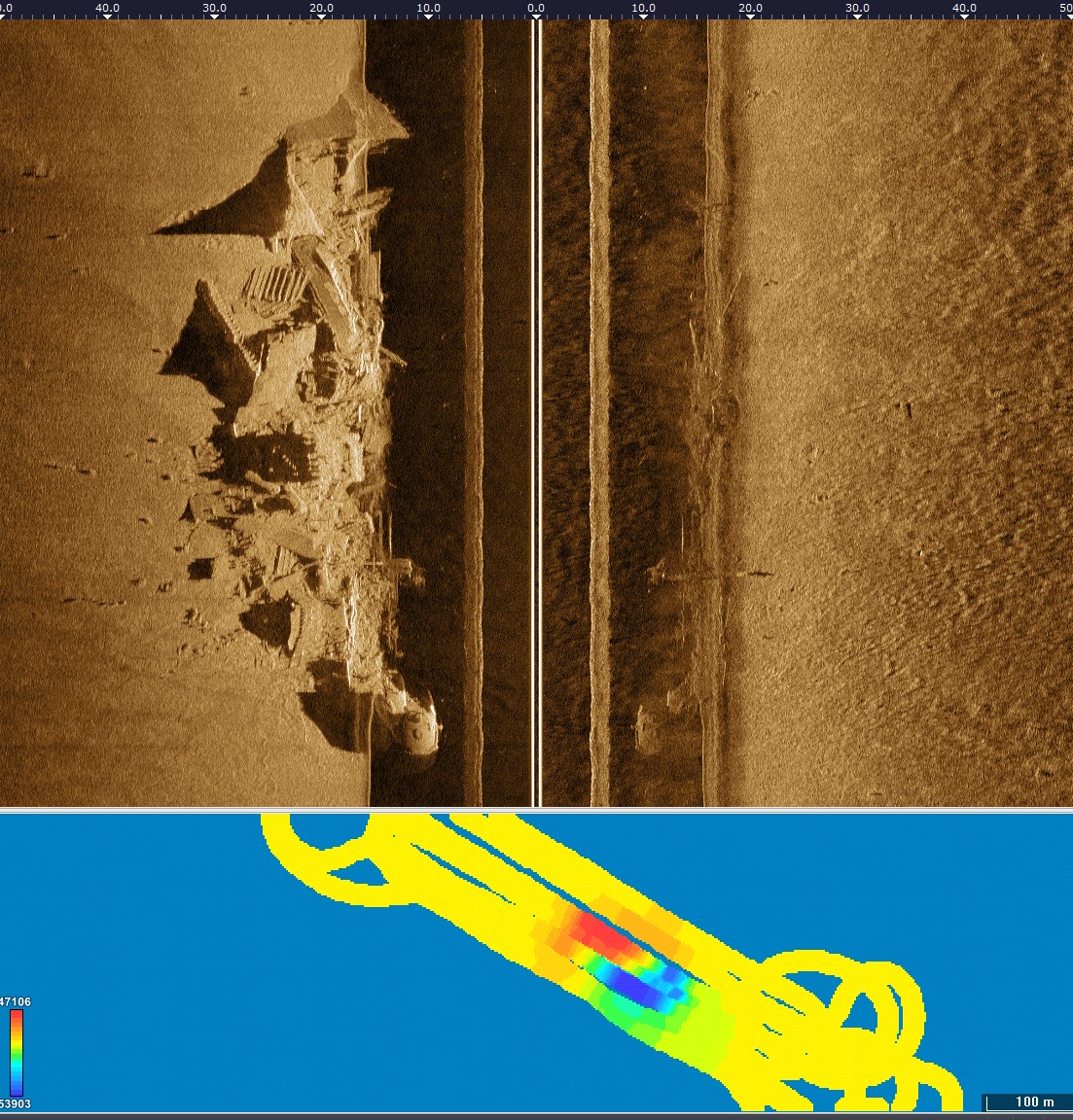
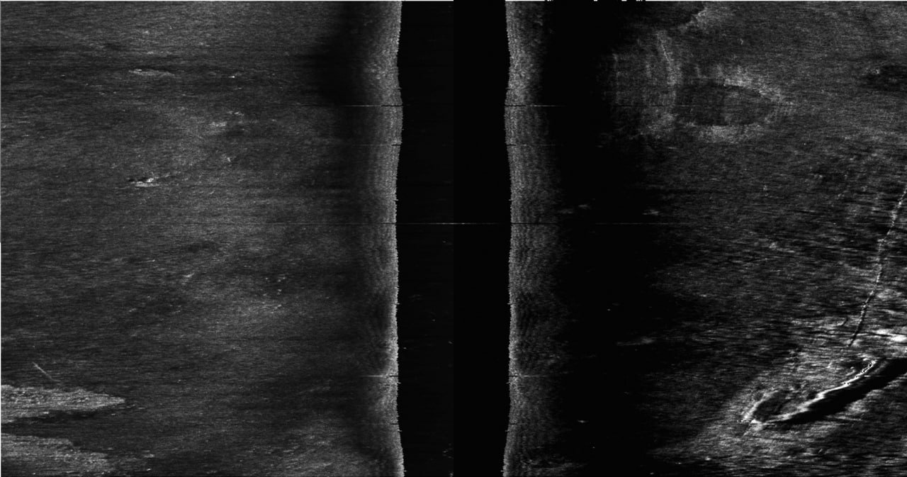
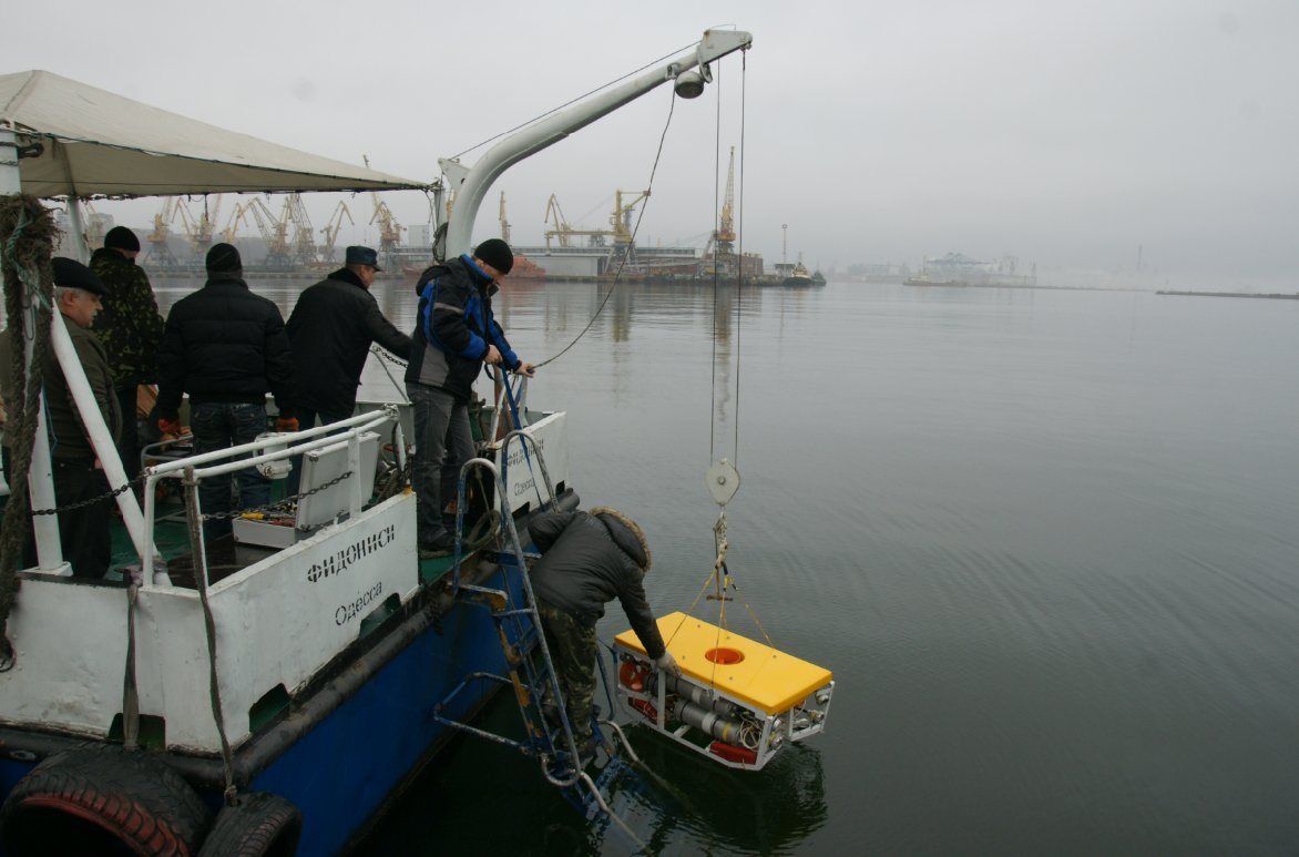
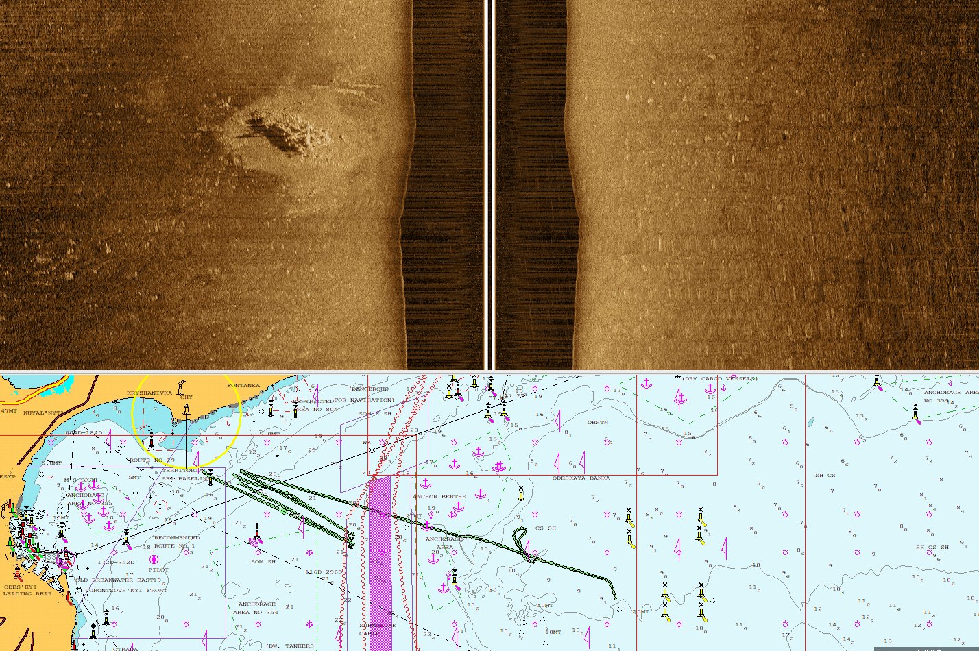
Full-cycle sonar expertise — hardware R&D, custom acquisition software, cartographic surveys, and field service. From the lab to the seabed.

15+
Years Experience
200+
Survey Missions
6
Sensor Platforms
// What We Do

Full-cycle sonar expertise.

From hardware design and field testing to data processing software and complete cartographic deliverables.

01

Sonar R&D

Design, prototyping and field testing of single-beam, multibeam, and side-scan sonar systems for marine and industrial applications.

02

Software Development

Custom acquisition, processing and visualization software. Real-time pipelines, signal processing, object detection, and 3D point-cloud tools.

03

Cartographic Surveys

Hydrographic and bathymetric surveys using multibeam echosounders, sub-bottom profilers, magnetometers, and LiDAR fusion workflows.

04

Maintenance & Service

Preventive maintenance, calibration, sensor overhaul, and field support for third-party sonar and survey equipment.

Precision mapping
for every mission.

We deploy multi-sensor platforms to deliver accurate, georeferenced seabed maps — from harbour approach channels to offshore deep-water areas. Every survey is conducted to IHO S-44 standards and delivered in client-ready GIS formats.

Our cartographic workflows integrate side-scan sonar, multibeam echosounder, sub-bottom profiler, and magnetometer data into a single co-registered dataset — enabling detailed analysis of seabed morphology, sediment type, buried hazards, and underwater infrastructure.

TASK 01

Navigational Safety Surveys

Detection and charting of underwater hazards — wrecks, unexploded ordnance, boulders, and shoals — to ensure safe passage in port approaches, fairways, and anchorage areas.

TASK 02

Bathymetric Charting

Full-coverage depth surveys using calibrated multibeam echosounders. Production of electronic navigational charts, paper charts, and 3D digital terrain models compliant with IHO and IMO requirements.

TASK 03

Port & Harbour Inspection

High-resolution mapping of berths, quay walls, breakwaters, and approach channels. Dredging volume calculations, sedimentation monitoring, and infrastructure condition assessment.

TASK 04

Pipeline & Cable Route Survey

Pre-lay route assessment and as-built surveys for submarine pipelines and cables. Detection of free spans, crossings, and burial depth anomalies using SSS and sub-bottom profiling.

TASK 05

Environmental & Habitat Mapping

Seabed classification and benthic habitat mapping for environmental impact assessment, marine protected area management, and coastal zone planning using acoustic backscatter analysis.

TASK 06

Search & Object Localisation

Systematic SSS search for lost objects, aircraft, vessels, and archaeological targets. Sub-metre positioning of detected objects with co-registered bathymetric 3D models.

Shipwreck SSS and bathymetry
SSS + Bathymetry

Shipwreck Detection & 3D Model

Side-scan image with co-registered multibeam bathymetric model.

SSS waterfall
SSS · Waterfall

Open-water Seabed Mapping

Sediment texture, benthic objects, buried feature detection.

Field deployment Odessa
Field Operations

Equipment Deployment, Odessa

Sonar platform lowered from survey vessel — pre-survey operation.

// Proprietary Software

Real-time detection
& mission control.

Our in-house software fuses magnetometer data, drone telemetry, and sensor feeds into a live operational picture.

Live · Mission Control
Sonarvia detection software
Object & Anomaly Detection

Automated heatmap generation from magnetic field data. Threshold-based classification and labelled anomaly tracking across multi-drone sweeps.

Multi-drone Mission Planning

Configure drone count, safe zones, deviation corridors, speed profiles, and altitude layers. Live ship autopilot integration.

Sensor Fusion & GIS Export

Overlay acoustic, magnetic, and optical data on georeferenced charts. Export to standard GIS formats.

SSS Contact Analysis — SDAA

Automatic contact detection with ping-level localisation, heading, rectangle dimensions, and depth data. Positional accuracy to sub-metre for identified seabed objects.

Real-world Detection Results
Underwater mine identification — visual and acoustic confirmation
Spherical mine on seabed — ROV
ROV · Visual
Spherical Mine

Biofouled spherical contact mine on seabed. Depth: ~50 m. Confirmed by ROV visual survey.

Box mine on seabed — ROV
ROV · Visual
Bottom Mine

Rectangular bottom mine — heavily encrusted. Located via SSS, confirmed by ROV inspection.

SSS contact SDAA analysis
SSS · SDAA
SSS Acoustic Contact

SDAA v1.3 contact analysis: Ping 338, depth 22.6 m, 16×3 m rectangle, heading 227°.

// How We Work

From brief to bathymetric chart.

A structured engineering workflow — validated, publication-ready deliverables every time.

01

Requirements

Define scope, depth range, resolution spec, and output format.

02

System Setup

Sensor selection, mounting, calibration, software configuration.

03

Acquisition

Survey execution with real-time QC and redundant data logging.

04

Processing

Cleaning, filtering, georeferencing, multi-sensor fusion.

05

Deliverable

Charts, 3D models, GIS layers, and technical report.

// Survey Data

Raw data from the field.

Real survey results — seismic profiling and multibeam bathymetry from recent projects.

Sub-bottom Seismic Profile
SBP · Sub-bottom

Sub-bottom Seismic Profile

High-resolution SBP record showing sediment layering and acoustic stratigraphy. Depth scale to ~200 m. Coordinates annotated along the track line.

Multibeam Bathymetry
MBES · Bathymetry

Multibeam Bathymetric Model

Colour-coded depth model from MBES data. Warm tones (red/orange) — shallow; cool tones (blue/purple) — deep. Intersecting survey track lines visible.

Ready to go deeper?

Tell us about your project — survey brief, R&D challenge, or software requirement. We'll respond within one business day.

info@sonarvia.com